Related Content
- Jurisdiction
- Equitable Jurisdiction
- Venue
- Class action
- Class Representative
- Individual plaintiffs
- Defendant Scottish Power
- Defendant PacifiCorp
- Defendant PPM Energy Inc.
- Scottish Power and commercial wind power development
- Defendant Greenlight Energy Inc.
- Sale of Elk River Windfarms LLC
- Defendant The Empire District Electric Company
- The Empire District Electric Company and the Elk River Project
- The Flint Hills Ecoregion
- Flint Hills Endangered Flora & Fauna
- The Native Prairie Grasslands
- Tallgrass Prairie National Preserve
- Legislative History: Tallgrass Prairie National Preserve
- The Konza Prairie Site
- The LTER Program
- The Prairie Parkway
- The Flint Hills Scenic Byway
- Flint Hills Scenic Resources
- International recognition of the Tallgrass Prairie
- Birds of the Tallgrass Prairie
- Tourism
- Beneficial impacts of tourism
- Economic impacts of tourism
- The Blue Ridge Parkway Experience
- Serious, permanent & irreparable damage
- Wind turbines kill birds of prey
- Wind turbine development destroys habitat
- Wind turbine development damage
- Damage to quality of life
- Wind turbines: an economic catastrophe
- Tax avoidance and subsidies
- Voodoo economics of wind turbine power
- Catastrophic wind turbine failures
- The Electric Power Grid
- The prayer for relief
Tallgrass Prairie National Preserve
64. The Tallgrass Prairie National Preserve is 10,894 acres of rolling grassland located in northern Chase County, in the heart of the Flint Hills region. Two major creeks, Fox Creek and Palmer Creek, numerous springs, seeps, and stock ponds dot the landscape. Prominent buildings and structures link the site to its ranching history along with a unique collection of cultural and natural features, allowing the Tallgrass Prairie to tell the story of human interaction with the environment from pre-contact times to the present.
64.1 The following photographic exhibit is a fair and accurate representation of the historic ranch house at the Tallgrass Prairie National Preserve.
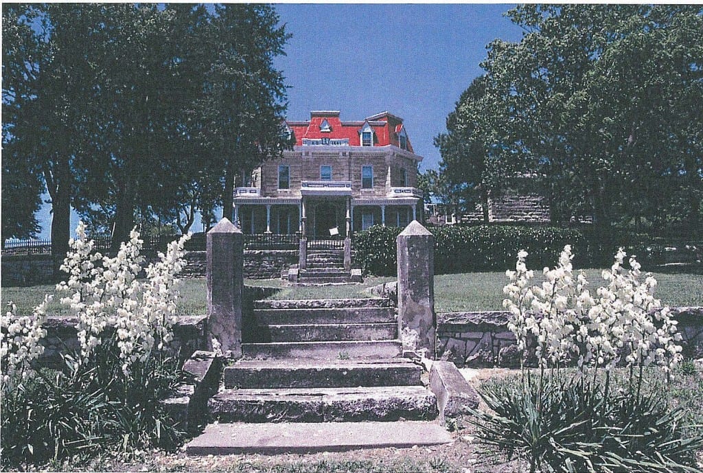
64.1 Flint Hills Historic Ranch House
64.2 The following photographic exhibit is a fair and accurate representation of Fox Creek School and a diversity of prairie plants on the Tallgrass Prairie National Preserve.
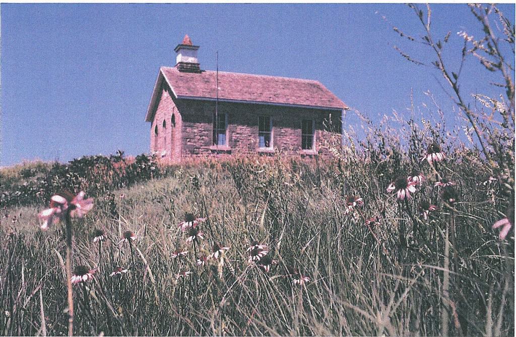
64.2 Fox Creek School House
Legislative History
65. The Tallgrass Prairie National Preserve, previously known as the Z-Bar (Spring Hill) Ranch, was proposed by Ron Klatasake, West Central Regional Vice President of the National Audubon Society in January 1989. The West Central Regional Office of the National Audubon Society, the predecessor to Audubon of Kansas, Inc., obtained a purchase agreement on the property from Boatmens National Bank of Kansas City in June 1988. Members of the Kansas Congressional delegation were informed and a plan was developed to be shared with the public. The proposal was based on purchase of the property on a willing-seller basis to establish a Tallgrass Prairie unit of the National Park system.
65.1 The National Park Service had recognized the need for a true Tall Grass Prairie National Park since the 1950s. In 1962 the U.S. Department of The Interior proposed establishment of a 57,000 acre “Prairie National Park” in Pottawatomie County Kansas. However, following United States Corps of Engineers acquisition of thousands of acres of adjacent land for construction of the Tuttle Creek Dam and reservoir, the prospect of additional forced sales was bitterly opposed by many local landowners and other residents and that proposal was dropped.
65.2 However, interest in preserving a substantial representative of tallgrass prairie remained high among Kansas residents, ecologists and scientists, and several national conservation organizations. An organization named the Save The Tallgrass Prairie (STP) was formed to specifically promote establishment of a Tallgrass Prairie National Park. When the Kansas Congressional Delegation was approached with a request to pursue legislative sponsorship in 1973 members of the delegation expressed reluctance because a specific site and size had not been identified.
65.3 Audubon’s Kansas-based representative at that meeting, recommend commission of a study by the National Park Service, and the delegation proceeded with a $50,000 appropriation request. Congressman Keith Sebelius (R-KS) served on the National Parks Subcommittee and he provided leadership support, along with Senator James B. Pearson (R-KS).
65.4 The National Park Service completed a comprehensive study of sites in 1975 and all of the remaining intact prairie landscapes were evaluated and mapped. The only sites worthy of evaluation were located in the Flint Hills Tallgrass Prairie Ecoregion. Three sites consisting of from approximately 60,000 acres to 90,000 acres were suggested as most suitable including one in Wabaunsee County, another principally in southeastern Chase and eastern Butler counties, and a third in the southern Flint Hills of Kansas extending into Osage County Oklahoma.
65.5 A bill was introduced by Congressman Larry Winn (R-KS) in 1977 calling for creation of a 185,000 acre Tallgrass Prairie National Park and Preserve. Kansas conservationists had generally pursued the concept of a 60,000 to 90,000 acre national park consistent with the National Park Service report-:—it was acknowledged that for grassland birds and most plant and animal species of the Flint Hills Tallgrass Prairie Regional Ecosystem landscape of traditionally managed rangeland would effectively provide genetic diversity and enhance population survival. The National Audubon Society’s west central regional office/regional representative and the Kansas Audubon Council did not endorse the proposal because it was based on acquisition of private ranch land by eminent domain.
65.6 Ranchers, agricultural organizations and many others strongly opposed the legislation for the same reason. The threat of eminent domain and the determination of most landowners to retain their property, and for many the concern for their family heritage of many generations associated with the land, and their way-of-life caused Audubon to explore other approaches to establishing a National Park.
65.7 Some ecologists suggested that a large prairie landscape was needed to maintain a functioning ecosystem with representative flora and fauna, and to provide visitors with an opportunity for a “prairie experience”. As Walt Whitman observed and elegantly wrote in 1879: “While I know the standard claim is that Yosemite, Niagara Falls, the Upper Yellowstone and the like afford the greatest natural shows, I am not so sure but that the Prairies and Plains last longer, fill the esthetic sense fuller, precede all the rest and make North America’s characteristic landscape.”
65.8 Audubon’s regional vice president began working with William R. Browning of Madison and other ranchers to pursue alternative acquisition approaches.
65.9 In October 1983 the 30,000 acre Barnard Ranch in Osage County Oklahoma was advertised for sale. With approval of the trustees for the property, Audubon suggested consideration of legislation that would incorporate the Chapman-Barnard Ranch within the boundaries of a 60,000 acre Tallgrass Prairie National Park or Preserve, and authorize acquisition of the Barnard Ranch. Additional owners of the adjacent Adams Ranch later expressed willingness to have their property included in a national park service proposal.
66. Legislation was introduced with bipartisan support of all members of the Oklahoma Congressional Delegation . Prospects for passage were bright. However, one of four major conservation organizations, the Sierra Club, raised objections to some provisions of the bill in a manner that was inconsistent with a prior pledge and agreement with members of the delegation. As a result, a key member of the Oklahoma Delegation withdrew his support and the opportunity to establish a Tallgrass Prairie National Preserve administered by the National Park Service in Oklahoma with federal acquisition of major portions of the Barnard, Chapman and Adams ranches was lost.
66.1 The Adams Ranch was sold, and then in an attempt to preserve the Barnard Ranch specifically for conservation purposes Tulsa businessman Joe Williams spearheaded a successful effort to acquire the property for a prairie preserve under the stewardship of The Nature Conservancy.
66.2 A bill to create the Tallgrass Prairie National Preserve in Kansas and provide for acquisition by the National Park Service was initially drafted by Audubon and Chase County community leaders and then introduced by Congressmen Dan Glickman (D-KS), Jan Meyers (R-KS) and Jim Slattery (D-KS). The bill was approved by the United States House of Representatives on 15 October 1991. However, the United States Senate did not follow the House ‘s leadership during that session of Congress.
67. In 1974 the National Parks and Conservation Association, creator of the National Park Trust, agreed to purchase the Z-Bar (Spring Hill) Ranch with the National Audubon Society holding the purchase agreement. U.S. Senator Nancy Kassebaum lead congressional efforts to authorize the Preserve. She sponsored a bill that limits federal ownership of the preserve to a maximum of 180 acres. The remainder of the property was to be owned by the National Park Trust or a successor conservation entity. Currently, the Park Service owns 32 acres. The balance of the ranch is owned by the National Park Trust, a non-profit group that purchases lands to protect them from development. The trust sold a 35 year cattle grazing lease to raise funds for operations and mortgage payments.
68. In January 2004, Governor Sebelius announced plans to involve the State of Kansas in a more active role in the development of the entire Z-Bar Ranch. On April 6, 2004, the Governor hosted a special conference in Cottonwood Falls to discuss the purchase of the Preserve by the Kansas Park Trust, a new private trust that will replace the National Park Trust as the owner of the Z-Bar Ranch. Even with transfer of ownership, the Preserve could still be managed by the National Park Service. Under the leadership of Governor Sebelius, former Senator Kassebaum-Baker, former USDA Secretary Dan†Glickman, and former Governor Mike Hayden, the Kansas Park Trust proposed to raise private monies to cover the current mortgage and re-purchase the grazing rights. The new plan calls for re introducing a few Bison, building a visitor’s center, and extending hiking trails. These measures, along with prairie restoration activities will enhance visitor interest and increase tourism in Chase County and the Flint Hills.
69. On November 12, 1996, legislation was passed creating the The Tallgrass Prairie National Preserve in the Flint Hills region of Kansas and a General Management Plan (GMP) was completed in September 2000
70. The Tallgrass Prairie National Preserve is a public/private partnership and its mission is to preserve and enhance a nationally significant remnant of the Tallgrass Prairie ecosystem and the processes that sustain it; preserve and interpret the cultural resources of the preserve and the heritage associated with the ranch property; and offer opportunities for education, inspiration, and enjoyment through public access to its geological, ecological, scenic, and historical features.
71. The Tallgrass Prairie National Preserve has been established as a unit of the National Park System to preserve, protect, and interpret for the public a remnant of the once vast Tallgrass Prairie ecosystem.
72. The Tallgrass Prairie National Preserve is a new kind of national park. The preserve is 10,894 acres. Most of that land has remained under the ownership of the National Park Trust, which purchased the land in 1994.
73. According to the National Park Service Grasslands Management Plan, this remnant exists today because of a complex history of interaction between people and the land.
74. Included in the Grasslands Management Plan are about a dozen “desired futures,” or conditions that will allow the preserve to achieve its purpose. Among these is an open and unobstructed view: “The vistas and views have been repeatedly identified by the public as some of the Preserve’ s most important resources. The relationship of earth and sky, the feeling of vastness, and the openness of the landscape all contribute to a ‘sense of place’. Existing developments should be managed to enhance views (i.e. power lines buried), and future developments should enhance and not detract from this important resource.”
74.1 The following photographic exhibit is a fair and accurate representation of sunset on the Tallgrass Prairie.
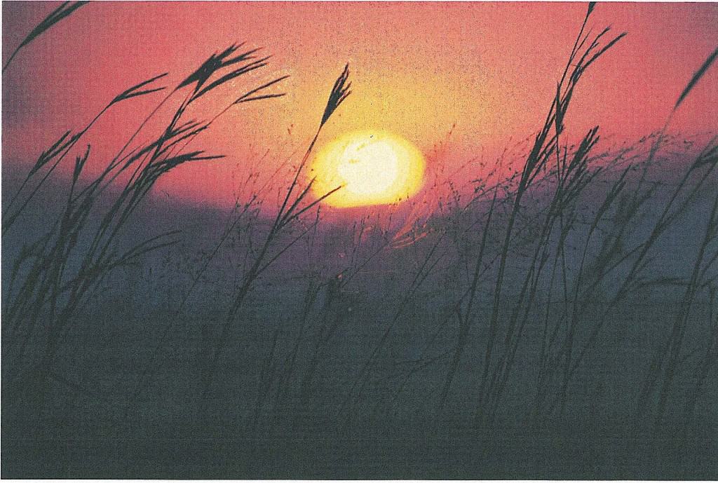
74.1 Sunset over the Tallgrass Prairie
74.2 The preceding photographic exhibit is a fair and accurate representation of earth and sky on the tallgrass prairie.
75. The 1996 legislation calls for the entire acreage to be managed cooperatively by the National Park Service and the National Park Trust.
76. On September 20, 2002, the National Park Trust donated to the National Park Service approximately 32 acres which included the historic 1880s ranch house, limestone barn and outbuildings, and one-room schoolhouse.
The Konza Prairie Site
77. The Konza Prairie Biological Station (KPBS) is representative of native Tallgrass Prairie in the Flint Hills of eastern Kansas. Because of the relatively steep topography and rocky soils characteristic of the region, this grassland has never been plowed.
78. Konza Prairie was established as a research natural area in 1972 primarily as a result of the efforts of Lloyd C. Hulbert. The first acquisition involved 916 acres near Interstate 70. A Conservancy office was not established at the time, and in the early 1970s when the 7,220 acre Dewey Ranch was listed for sale Ron Klataske, the west central regional representative of the National Audubon Society contacted The Nature Conservancy through Dr. E. Raymond Hall encouraging TNC to consider the potential acquisition. He was in the Riley County Courthouse obtaining the requested legal description on the day the Manhattan Mercury reported that the property had been sold in a private sale. The Conservancy later purchased the property from that party.
78.1 The following photographic exhibit is a fair and accurate representation of a bull elk.
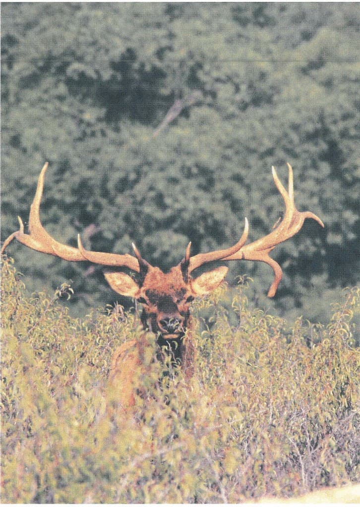
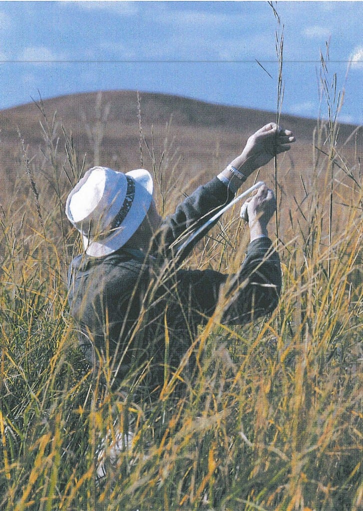
78.1 Bull Elk in the Tallgrass Prairie
79. The land was originally acquired by the Nature Conservancy with funds provided by Katherine Ordway and is leased to the Division of Biology at Kansas State University for research purposes. Dr. Hulbert initially established a watershed-level fire-frequency experimental design that included-replicated unburned and annual, 2, 4, and l0 year frequencies of prescribed spring fire. Overlaid on this design was a grazing experiment with blocks of watersheds designated as ungrazed, grazed by native ungulates (Bos bison) and watersheds grazed by domestic cattle (Bos taurus). With only minor modifications, Dr. Hulbert’s design has been fully implemented. Fire treatments have been maintained in the southernmost watersheds since 1971, and throughout the rest of Konza Prairie since 1979. Bison were reintroduced to Konza Prairie in 1987 and experimental cattle herds in 1992. The union of Hulbert’s experimental plan for Konza Prairie with the National Science Foundation Long Term Ecological Research (LTER) initiative has resulted in a statistically robust, ecological research program designed to elucidate patterns and processes important in Tallgrass Prairie. In contrast to a monitoring approach to long-term studies, the Konza Prairie LTER program is an example of an experimental paradigm with a long time frame. As such, it contains what Krebs (1991) has argued are the “essential components of the 21st century” research program.
79.1 The following photographic exhibit is a fair and accurate representation of ongoing research activity in the Tallgrass Prairie of the Flint Hills. It shows Dr. Lloyd C. Hulbert in Prairie Cordgrass.
79.2 Dr. \ Lloyd C. Hulbert in Prairie Cordgrass
79.2 The following photographic exhibit is a fair and accurate representation of a controlled burn during the springtime on the Flint Hills Tallgrass Prairie. Controlled burning as an alternative to prairie wildfires is a management practice employed by ranchers and prairie managers fnroughouf file FlinCHills Tallgrass Prairie Regional Ecosystem and it is a subject of research at Konza Prairie.
79.3 The following photographic exhibit is a fair and accurate representation of adult Bison cows with a calf in the tallgrass prairie at Konza.
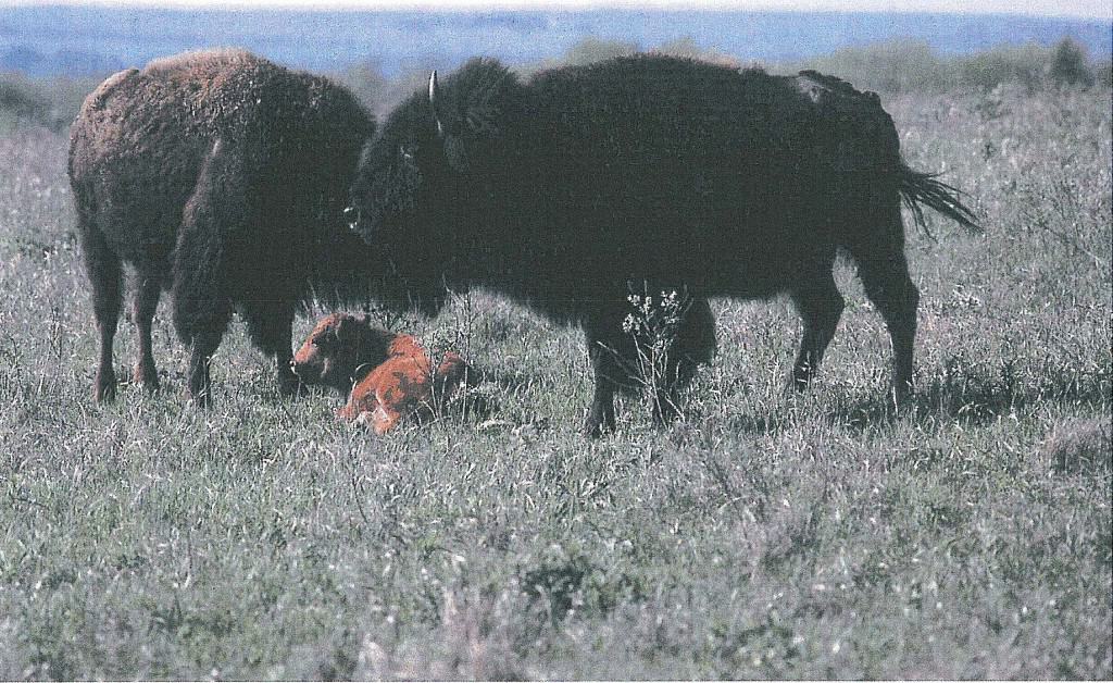
79.3 Bison cows and calf
The LTER Program
80. The National Science Foundation’s Long Term Ecological Research (LTER) Program began funding research in 1981 after a series of workshops and planning meetings in the late 1970s. Rationale for development of the LTER program included explicit recognition of the low rate of change of many significant ecological processes, the importance and prevalence in most ecosystems of rare events and episodic phenomena with long return intervals, the tremendous interannual variability of many ecological processes, and the value of long-term databases for providing the context for shorter term studies.
80.1 The LTER program was designed to support a multidisciplinary approach to addressing long-term questions in a wide variety of biomes in North America and beyond. Coordinated research among the network of LTER sites (numbering 24 in 2000) is encouraged to enhance our understanding of ecological phenomena and processes operating over broad spatial scales, as well as long-time scales.
80.2 LTER sites conduct research in 5 general “core” areas. These core areas focus on understanding and documenting (1) patterns and controls of primary production (to study the energy limitations to ecosystem function), (2) spatial and temporal dynamics of key populations (selected to represent trophic structure to identify major pathways of mass and energy transfer and the structural organization of the ecosystem), (3) patterns and controls of organic matter accumulation in surface layers and sediments (to elucidate storage and processing of biological materials), (4) patterns of inorganic input and movements through soils, groundwater, and surface water (to assess interactions among geochemical and biological processes), and (5) patterns and frequency of disturbances to the system (to compare nature and humans as perturbers of natural systems).
80.3 Konza Prairie was one of the 6 original LTER sites selected by National Science Foundation in 1981.
80.4 From 1981 through 1986, the initial research program involved comparative investigations of biotic responses to fire and climatic variability. Long-term research sites and sampling protocols were established during this period with an emphasis on studies of the extremes of annually burned vs. unburned watersheds and upland vs. lowland sites.
80.5 From 1986 through 1990, research efforts expanded to include a wider range of fire frequencies, specifically 4-yr fire cycles, and increased exploration of ecosystem responses. Researchers began to address more complex questions of scale and make use of remotely-sensed satellite data to explore landscape-level issues.
80.6 From 1991 through 1996, the primary research goals were to understand how grazing influences biotic and ecosystem processes and patterns imposed by fire frequency over the landscape mosaic,all of which are subjected to a variable and possibly directional climatic regime. The additional research associated with large ungulate grazing and an expanded landscape perspective were designed to complement programs at other LTER sites as well as enhance efforts within the LTER core areas.
80.7 From 1996 through 2002, researchers continued to build on existing long-term studies of fire, grazing and climatic variability with a broadly-based research program encompassing studies from the organismic through population, community, ecosystem and landscape levels. The research effort expanded to include studies of climate change, net carbon exchange, restoration ecology and land use/land cover change. These studies are thematically linked via an overarching theme that explicitly includes a non-equilibrium perspective on ecological patterns and processes in this grassland and which addresses the major abiotic and biotic factors influencing this ecosystem.
81. The central hypothesis of the Konza research effort is that fire, grazing and climatic variability are essential and interactive factors responsible for the structure and dynamics of Tallgrass Prairie. In contrast to many other grasslands where ecological processes are constrained by chronic limitations of a single resource such as water, organismic to ecosystem processes and dynamics in Tallgrass Prairie are products of spatial and temporal variability in multiple limiting resources including water, light, and Nitrogen. Variability in, and switching among, these primary limiting resource(s) are caused by both extant and historical fire, grazing and climatic regimes. Moreover, responses to these factors are strongly dependent on topographic and landscape position. As a result of this complexity, and because grazing and fire regimes are managed in grassland systems worldwide, data from the Konza Prairie LTER program have relevance not only for understanding this
grassland, but for broader ecological issues such as stability-diversity questions and interactions among land-use, biodiversity and climate change.
81.1 The following photographic exhibit is a fair and accurate representation of the Flint Hills Tallgrass Prairie at Konza in the fall.
81.1 Tallgrass prairie at Konza
Prairie Parkway
82. In 1967 the Kansas Legislature passed a bill establishing the Prairie Parkway extending south from the Pony Express Station near Hanover through the Flint Hills to Elgin. Elgin is near Sedan, a community that is striving to project a prairie heritage and the tourism potential of the southern Flint Hills with help from Bill Kurtis.
82.1 The following photographic exhibit is a fair and accurate representation of the Kansas State identification sign for the Prairie Parkway.
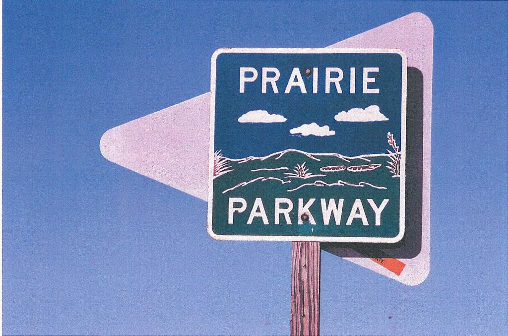
82. Prairie Parkway
83. The Tallgrass Prairie National Preserve is one of the flagship attractions along the parkway. Audubon of Kansas in partnership with the Kansas Department of Transportation and the Division of Tourism in the Kansas State Department of Commerce is currently developing a statewide system of Kansas Birding and Natural Heritage Trails including a Tallgrass “Prairie Parkway” Birding and Natural Heritage Trail closely following the Prairie Parkway route. A six-state “Prairie Passage” parkway from Texas to Minnesota is considering two routes which include the southern and central Flint Hills.
84. The Skyline-Mill Creek Scenic Drive is another long established scenic route in the Flint Hills. It was designed by Wabaunsee County officials and it extends largely on county roads from Alta Vista through Alma to I-70 east of Paxico.
85. The proposed Munker’s Creek industrial wind turbine commercial electric power generation facility site will be visible from this route.
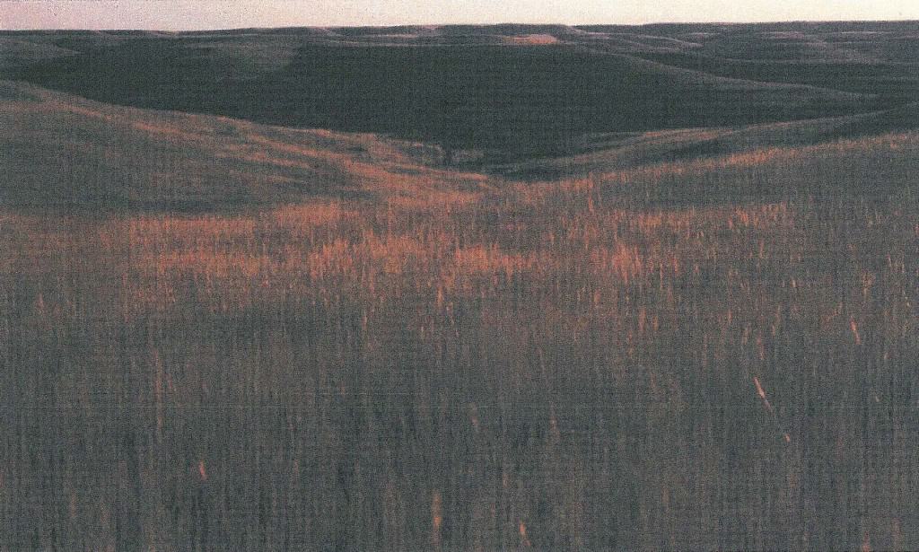
85.1 The following photographic exhibit is a fair and accurate representation of winter on the Flint Hills Tallgrass Prairie as seen from the Prairie Parkway.
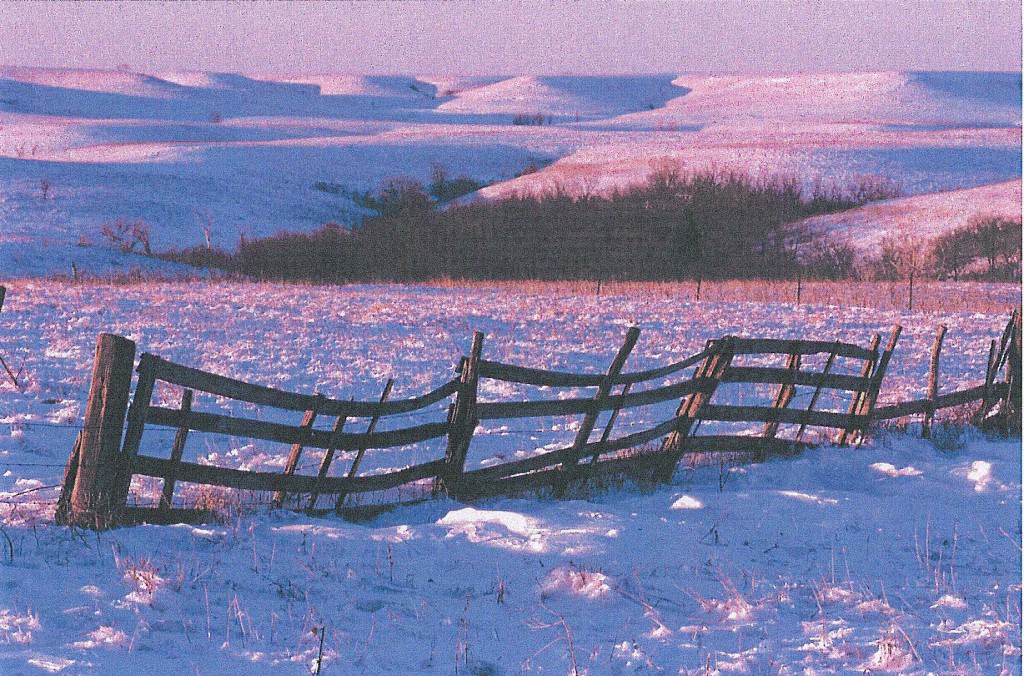
85.1 Tallgrass Prairie Winter
Flint Hills Scenic Byway
86. The Flint Hills Scenic Byway is a beautiful drive year-round showing off the panoramic vistas of the Tallgrass Prairie along 47.2 miles through the Flint Hills of Kansas on Highway K- 177 between Council Grove and Cassoday. Historic sites abounCl in the region incluCling tlie Kaw Mission and the Last Chance Store in Council Grove, and the Chase County Courthouse in Cottonwood Falls.
86.1 The following photographic exhibit is a fair and accurate representation of the Last Chance Store in Council Grove, Kansas.
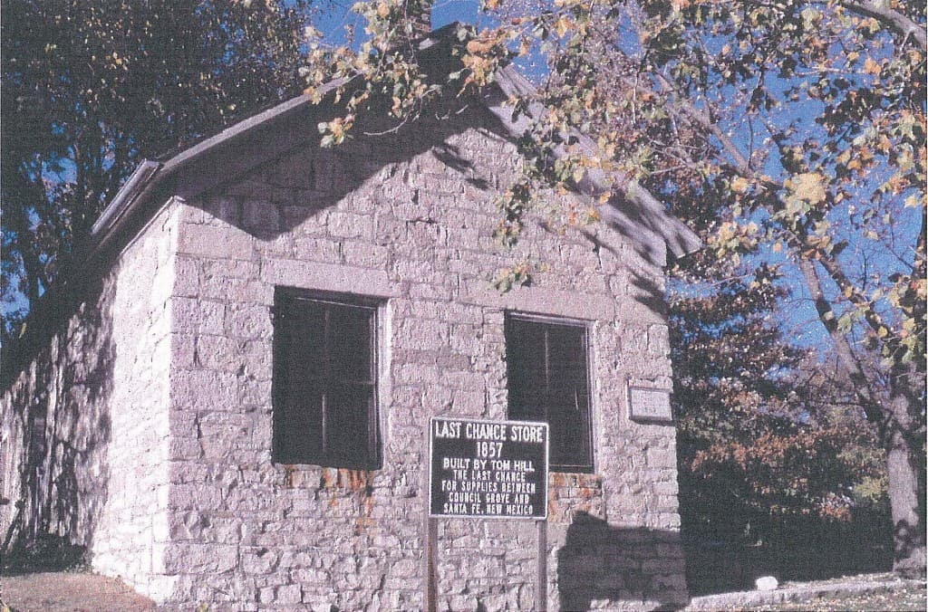
86.1 Last Chance Store
87. The Flint Hills Scenic Byway was designated a Kansas Scenic Byway on June 14, 1995 by the Kansas Secretary of Transportation.
88. The Byway passes the Tallgrass Prairie National Preserve and follows the roadway through Strong City and Cottonwood Falls, site of the Chase County Courthouse which has been in operation since 1873.
88.1 The following photographic exhibit is a fair and accurate representation of the Chase County Courthouse.
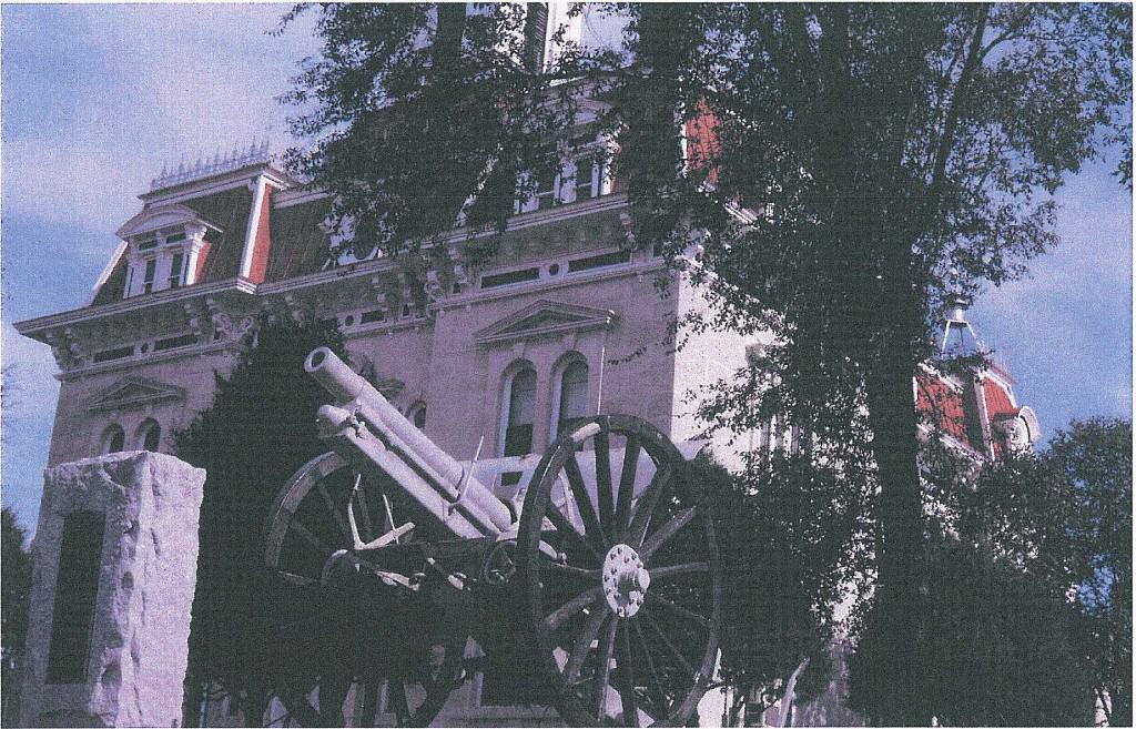
88.1 Chase County Courthouse
89. South of Cottonwood Falls, the Flint Hills Scenic Byway travels atop the hills for more panoramic views of the prairie landscapes and ranches in the area, then dips down into the creek bottomlands to follow magnificent stone walls around farmsteads still in operation.
90. The Flint Hills Scenic Byway takes the traveler deep into the heart of the Flint Hills where the sky expands and the land begins to rise and fall like waves on a sea of grass.
90.1 The following photographic exhibit is a fair and accurate representation of a Flint Hills Tallgrass Prairie Regional Ecosystem viewshed.

90.1 Flint Hills Tallgrass Prairie viewshed
91. Much of the land in an area 30–40 miles wide along the byway has remained relatively unchanged for thousands of years. The Plains Indians, such as the Kaw and Osage, made the prairie their home using pieces of chert found here for their tools and weapons. Early settlers crossed over the land, finding it too steep and rocky to farm. The Byway is a journey into the history of the American West.
91.1 The following photographic exhibit is a fair and accurate representation of the kind of rocky landscape the early settlers found as they made their way West.

91.1 Flint Hills rocky landscape
92. In 1999, Goals for the Corridor Management Plan were set forth and a primary goal of the Corridor Management Plan was to preserve the intrinsic resources of the byway by conserving the intrinsic resources of the scenic byway in a sustainable balance with economic development and tourism and develop a sense of joint stewardship by all users-visitors, property owners, and managers.
93. The Corridor Management Plan encouraged tourism and suggested developing an overlook at Schrumpf Hill, recently established by the Kansas Department of Transportation.
94. The Corridor Management Plan identified a substantial number of key resources, including scenic, historic, cultural, natural, recreational, archeological, and national register listings as well as tourist amenities such as dining, lodging, picnic areas, camping, and visitor facilities.
95. National Scenic Byway designation was considered but was not pursued in the past. The next time that an application for federal recognition may be made is 2005.
Scenic Resources
96. The Flint Hills Scenic Byway Management Committee identified the following key scenic resource elements along the existing transportation corridors of the Flint Hills Tallgrass Prairie Ecosystem.
• Rogler Ranch Stone Fences north of Matfield Green
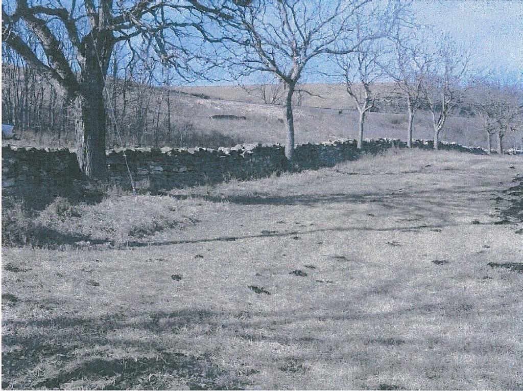
96_Rogler Ranch stone fence
• Railroad (Orient) right-of-way on east side of byway south of Matfield Green
• Schrumpf Hill 2.8 miles south of Cottonwood Falls
• Chase County Courthouse Cottonwood Falls
• eortonwood River Fatlseottonwood Falls
• Z Bar Ranch/Spring Hill Ranch/National Tallgrass Prairie Preserve north of Strong City
• River Walk Council Grove
• Madonna of the Trail Council Grove
• Kaw Indian Warrior sculpture Council Grove
• Numerous opportunities to view Flint Hills along the byway while driving
Historic Resources
97. The Flint Hills Scenic Byway Management Committee identified the following key historic resource elements along the existing transportation corridors of the Flint Hills Tallgrass Prairie Ecosystem.
• Cassoday Museum, Cassoday
• Railroad bridge over K-177 north of Cassoday
• Railroad section house north of Matfield Green
• Rogler log cabin north of Matfield Green
• Knute Rockne Memorial at Bazaar
• Bazaar cemetery at Bazaar
• Chase County Courthouse at Cottonwood Falls
• Cottonwood River Falls at Cottonwood Falls
• Roniger Native American Museum at Cottonwood Falls
• Sam Woods house (Private) – east of Cottonwood Falls
• Santa Fe Depot at Strong City
• W.B. Strong Memorial Railroad Park at Strong City
• Stone Arch Bridge over Fox Creek at Strong City
• Z Bar Ranch/Spring Hill Ranch/National Tallgrass Prairie Preserve north of Strong City
• Fox Creek School north of Strong City
• Santa Fe Trail at Council Grove
• Kaw Mission State Historic Site/Museum at Council Grove
• Old Bell Monument at Council Grove
• Farmers and Drovers Bank at Council Grove
• Council Oak at Council Grove
• Cottage House Hotel at Council Grove
• Conn Stone Store at Council Grove
• Council Grove National Bank Building at Council Grove
• Old Cowboy Jail at Council Grove
– Hermit’s Cave at Council Grove
• Seth Hays Home at Council Grove
• Cemetery Wall at Council Grove
• Last Chance Store at Council Grove
• Custer’s Elm at Council Grove
• Post Office Oak and Museum at Council Grove
• Neosho River Crossing at Council Grove
• Durland Park at Sylvan Park Depot, Caboose, Buckeye Oil Engine, KATY Depot – Council Grove
• Council Grove Lake and City Reservoir
98. In addition to historic and cultural activities, Morris County is the site of twin lakes where recreational opportunities abound. The twin lakes at Council Grove include the City Reservoir and the 3,000-acre federal Council Grove Lake. Visitors can enjoy many outdoor activities including fishing, camping, swimming, and boating.
Native Stone State Scenic Byway
99. A Native Stone State Scenic Byway Plan in Shawnee and Wabunsee Counties i s being developed. The proposed scenic byway will be approximately 64 miles long and begin at exit 353 on 1–70, just west of Topeka; then follow Auburn Road (K-4) south through Dover and Eskridge where the route b ecomes (K-4/K-9 9) and proceed west . At the T-intersection where K-4 and K-99 split, the byway will go both north and southwest. The northern route will end at exit 328 at I-70 and the southwest terminus will be at the intersection of K-4 and K-177.
99.1 The following photographic exhibits are fair and accurate representation of the view from a hillside northwest of Alma looking toward an area where industrial wind turbine commercial electric power generation facilities might be located and how a few of them might look from that location.
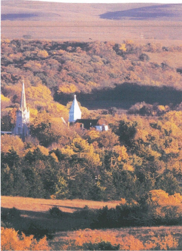
99.1 View from the Alma hillside
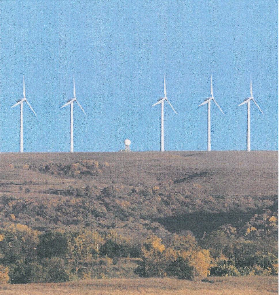
99.1 Windmills not church steeples
Please continue to the next section of the complaint, a detailed description of the Birds of the Tallgrass Prairie